
Last year Penny and I did the Spey Descent. It was a fantastic four-day adventure, a hugely satisfying journey from the Cairngorm mountains to the North Sea, through numerous rapids and an ever-changing river landscape. This year, Penny and I wanted a progression, an advancement that would test our skills. We decided upon the Tay Descent, from the village of Killin at the western end of Loch Tay, to Perth, where the river becomes tidal, then to Broughty Ferry in Dundee, a total distance of 145 km.
The journey would have a great deal of variety: 25 km of open water canoeing on Loch Tay, an 85 km river section with significant rapids at Grandtully and Stanley, and a 35 km tidal section involving canoeing in the sea in the Firth of Tay. We planned to undertake it in four days: a half day for Loch Tay, two full days for the river and another half day on the Firth of Tay. To achieve this we’d need good wind, a westerly, so we could canoe sail; and, we’d need an ebb tide on the Firth of Tay to push us speedily to Broughty Ferry.
Penny and I were pretty familiar with Loch Tay and much of the river section, but there were some big unknowns: we hadn’t run the rapids at Stanley, which included multiple grade 2/3 rapids; and, we hadn’t canoed in the Firth of Tay. We pondered over the speed of the tide in the Firth, strategies for avoiding being stranded on mud flats, whether to stick to the north shore or the south, or whether to head straight down the middle. We thought through the risk posed by big waves, strong offshore winds and shipping. How could we mitigate the risk of capsize, far from shore, with fast tides and choppy seas. It all felt pretty serious and consequential. Friends and colleagues were a big help in our research and after careful consideration, we decided to go for it, choosing a four-day period in late August, early September where the winds and tide would be in our favour.
Canoe journeys often begin with a good amount of logistically manoeuvering, and our beginning was no different. After a very early start on the 30th of August, I left my home in Kilsyth (just north of Glasgow) and drove to Killin. Upon reaching the banks of the river Lochay, the winding riparian highway that leads to Loch Tay, I unloaded and padlocked the canoes and drove on another two hours to meet Penny at Broughty Ferry, close to the castle. We left a vehicle and the canoe trailer there then headed all the way back to the river Lochay.
Water, hammock, tarp, sleeping bag, food, stove, fuel, crocs, camp chair, and home-made tea-bag firelighters; knife, sail, throw lines, paddles, karabiners, mast and bailer; wellies, buoyancy aid, dry-suit trousers, hat, gloves, sunglasses and sun cream. All was ready! All was neatly and satisfyingly packed in our 15.5 ft Hou prospector canoes. It was around 2 pm before we got onto the river. We were off!
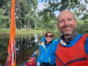
The trees swayed in the wind as we paddled east along river Lochay. It was a strong breaze, the kind of wind that bent slender tree trunks and the kind of power and force that filled one with trepidation. Upon reaching Loch Tay, we prepared to sail, sitting at the back of our canoes for the best ‘trim’, a position that afforded us the best balance and manoeuverability when sailing downwind. We planned to sail solo, a mode of travel that’s exhilarating but not without risk. A fickle unpredictable gust can so easily capsize a canoe, leaving the paddler facing the prospect of self-rescue, far from shore. Unfurling our sails the wind caught the orange fabric immediately and we were propelled east. The wind was good, a steady force three, a strength that’s perfect for canoe sailing, strong enough to drive your craft forward without the burden of paddling.
Before long Penny and I got into our sailing rhythm. The wind drove us forward, we’d catch a wave, we’d surge then slow in the trough. The wind and wave action would push the bow of the craft to starboard, and we’d effect a stern rudder, straightening our course, achieving a delightful balance that kept the wind in our sails, maintaining the momentum and forward energy of our canoes. Sometimes these balancing strokes could be made one-handed, gently; but, sometimes, a strong pry was needed, levering the paddle forcefully against the gunnel. With time, as one hour past, then two, this rhythm became intuitive our motion easy, blissful and weightless.
Penny and I had anticipated that the 24 km long Loch would take us 5 hrs or so to travel, broken up with breaks; but slowly, as headlands and hills past in our wake, it dawned on us that we might do it in one three hour stint. Unbelievable! We could hardly contain our delight in such easy, speedy progress. We saw the Crannog Centre come in to view, and then the bridge over the Tay at Kenmore, marking the end of the Loch. We glided under the bridge, and gently came ashore for a welcome break and shared reflections on a wonderful sail.
The river Tay is the longest and and biggest river by volume in the UK. It’s source is on the northern slopes of Ben Lui, way to the west. Here at Kenmore, at the eastern end of Loch Tay, the river is pretty big with a plenty of volume, making it an excellent river to paddle all year round. Our objective for the rest of the day was to paddle another 4-5 km to an island close to the confluence of the Tay and the river Lyon.
Penny and I played around in eddies, areas of slack water downstream of boulders, shingle bars and other river obstacles. It had been a few weeks since we’d canoed a river and this practice helped us to get a feel for the quick manoeuvering we’d need to do on the rapids ahead. The main rapid between us and our camp was Chinese Rapids, a long grade two, along a long right hand bend of the river. We’d both done the rapid before and we approached it without inspection or any apprehension. We lined up on river left, went under the bridge, marking the start of the rapid, and bounced down a series of waves, keeping clear, close to the bottom, of boulder and big wave that can sometimes cause problems. After that we continued on to our island and set up camp for the evening, erecting tarps and hammocks, and enjoying a warming fire and a good meal.
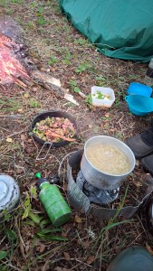

Day two would take us through Aberfeldy to the grade three rapids at Grantully, then on to the confluence with the river Garry, then south to Dunkeld and another island camp. This was a section of river we were familiar with and we made quick progress. The river was flowing well, adding to our speed. We stopped briefly at Aberfeldy to fill up our water containers and chat to the staff at Beyond Adventure, a water sports company, about canoeing the Firth. At Perth the river is tidal, and downstream it broadens out to a Firth (an estuary), 3-4 km across at it’s widest. The distance of this leg is 35 km and it was important to get it done in one ebb tide, during the six hour period between high tide and low tide when the sea is flowing out, in an easterly direction to the North Sea. Paddling against the tide would be impossible. Also, it was really important that we didn’t get stuck on the large mud flats that appear at low tide. The team at Beyond Adventure advised us that the tides were strong and fast and with the added assistance of a westerly wind, we shouldn’t have any problem covering the 35 km distance during our tidal window. Reassured by this we headed back to the river and continued on our way.
Downstream of Aberfeldy the character of the river is slow, sleepy, deep and meandering. All of a sudden however, halfway to Grantully, the character changes significantly, becoming fast, wavy, bouldery and exciting. Multiple sections of grade two rapids provided lots of fun and excellent preparation for Penny and I, before the main event, the grade 3 rapids at Grantully. Upon approaching the rapid we tucked into a eddy and took a moment to garner our courage. Grantully is actually a grade 3 followed by two grade 2 rapids, each following in quick succession. Penny and I had run it in May (see video below) and the line, which one needs to be pretty precise about, was fresh in our memory. I set of first, identifying a big rock Penny describes as a sea monster and a smaller rock to it’s left. The main flow passed between these rocks. I lined up and shot through the grade three, sweeping hard left with the strong flow of the rapid, then effecting a sharp turn to the right to avoid a big standing wave. After that there was brief pause to collect my composure before heading river right down the second grade 2 rapid, a straightforward wave train, that leads to an eddy by a road bridge. I turned upstream to watch Penny shoot the rapid. Penny has never capsized in a rapid, a consequence of paddling skill, excellent balance and her relative small size, in our voluminous 15.5 ft two person canoes. She ran the rapid with style, managing to tuck into eddies between each of the rapids. Pleased and relieved to have got through this major section of rapids, we decided to line our canoes down a broken weir, down stream of the bridge. The weir has a nasty recirculating tow-back, something that can capsize a craft and trap you underwater. Lining a canoe just means using a long rope to lower the craft down the river, whilst you stand on the riverbank.
After Grantully the river is less technical, mostly flat water, with some grade one rapids, all the way to Dunkeld, where there’s a grade 2 under the bridge. A headwind picked up on this section and I began to tire. I felt weary and struggled to keep up with Penny. I felt the onset of a fever with achy muscles and tiredness. After an 8 hour day we finally got to the day’s destination, another island camp downstream of Dunkeld. This island was delightful with lots of Scots Pines and a more open feel below the canopy. We set up camp again, made dinner, then, for me, went to bed early, at 6 pm.

South of Dunkeld the landscape along the river changes entirely. The Tay crosses the Highland boundary fault and enters Strathmore, an expansive area of Lowland Scotland, with fertile farmland. Our big challenge on day three was Stanley, a series of grade 2/3 rapids, unknown to either of us. To get to Stanley, however, we had 20 km or so of paddling on the Tay, now wide, full and meandering across the flood plain. We kept track of all the twists and turns in the river, marking our progress towards Stanley; and, did our best not to annoy the innumerable fishermen along the riverbank.
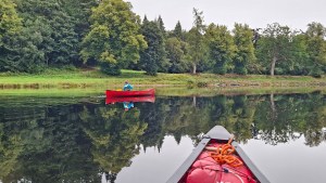
The Stanley rapids refers to a 6km stretch of the River Tay with the following cascades:
- Campsie Linn – a waterfall, formed by a quartz-dolerite dyke that stretches across the river. At low water levels the “waterfall” is 1m high, appearing as a tongue or shoot of fast moving water that powerboats can drive up and canoeists and kayakers can descend quite easily. At high water levels the flow of water over the dyke is monstrous, creating the largest waterfall by volume in the UK, with huge whirlpools and waves. Grade 2 to 4 depending on water levels.
- Stanely weir – a broken weir with various runnable lines, grade 2 (at low water levels)
- Hellhole Corner rapid – a top end grade 2 with bouncy waves.
- Stanley Mills Section – grade 2 rapid
- Thistlebrigg rapid – grade 2/3 rapid with choppy fast flowing water
As we approached Campsie Linn the shoot wasn’t at all apparent to us. This made us nervous! All we could see was this massive wall of rock stretching across the river. The water upstream of it was entirely flat and calm, leaving us puzzled about what lay ahead. A fisherman, in a boat close by, shouted some encouraging words and instructions: “First gap on the left, you’ll be fine. I drive the boat up it all the time”. I crept forward and the gap came into view, and it didn’t look bad at all. I lined up and ran the shoot, a fast descent down a smooth tongue of water leading to a bouncy wave train. No problem.
After that was Stanley Weir. We got out for this and made an inspection. Again, it looked fine. The line was clear, a gap in the weir on river left. In we went and ran that. It proved to be very straightforward.
The subsequent sections of rapid were a big surprise for us. We hadn’t anticipated there would be this much white water, or how much fun they’d be. I took the lead, reading the river as I went. This involves looking for looking for V-shaped tongues of water, indicating where the main flow of the river goes. It also involves looking ahead for boulders and big waves to avoid and eddies, affording you a safe haven from the fast flowing water. The rapids were fantastic, a bit technical but within our skill level and overall really good fun. Upon reaching the end of my impression was that Stanley was like an adventure playground for kayakers and canoeists. It was easily the most fun stretch of rapids I’d done and well worth visiting again.
After Stanley we had flat water all the way to Perth. Canoeing through the city was interesting. We got an entirely new perspective on the city and canoeing under Friarton bridge, carrying the M90, felt like a big milestone. It was late afternoon and we needed to find a place to camp. This would be tricky through. There weren’t that many trees on the river bank and the M90 was immediately adjacent to river left. Also, high tide was two hours away, and a stretch of mud and reeds separated us from the dry ground and trees we needed for our hammocks. We progressed downstream, scanning the river right for anywhere we could bridge the mud. After a while I found a spot where the riverbank was somewhat stony. I got ashore and picked my way across the stepping stones as best I could. I got so far then had to commit to the ooze, and embrace the suck. Yuck, it was slimy messy work finding a way through to firm ground, wellies sinking deeply into the mud, but I made it. Having found a suitable hammock camping spot, I returned to Penny and we proceeded to haul the canoes up the mud, getting even more messy.

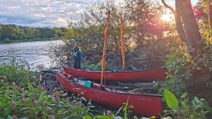

Day four, we rose early, at 5am, to catch the ebb tide. The tide was really high, a spring tide. The tides today, ebbing out to the North Sea, would be fast. The mud of yesterday was below water and we accessed the river easily. We did some solo sailing to start with, heading east to towards the rising sun. The wind forecast was force 5 to 7. This was a concern. We could expect some big waves further east. To start with the wind was fine, a force three and solo sailing was safe enough. Before long, however, we started to get some strong gusts, and we decided to raft up. We tied the canoes together, slightly offset, affording us lots of stability and greatly reducing the risk of capsize. Penny was at the stern and did all the steering. There wasn’t much for me to do really. The strong winds made us move quickly and my power strokes didn’t do anything to increase our forward motion. My job was navigation, looking ahead for tidal islands, providing Penny information on our course and looking for landmarks on the shore to gauge our progress. Our speed was 8-9km per hour. Fast!
After two hours we were in the middle of the Firth and about half way to Broughty Ferry. We were a long way from the shore and the waves were becoming choppy and awkward. On Loch Tay the waves had predictable peaks and troughs. Here, on the Firth, the waves were confused and agitated. The canoes strained disconcertingly against the ropes that tied them together, creaking and rubbing. Another hour on and the Forth Rail bridge was fast approaching. The wind was stronger now and the tide fast and powerful. We were flying along at 10 plus km per hour. The piers of the bridge are pretty close together and it became clear that getting past them could be hazardous. Just before passing underneath, we lost the control of the canoes and ended up side on to the waves and wind. This was dangerous moment and Penny and I worked hard to bring the canoes about. Penny did a great job to steer us through the peers, but the waves, between the piers, were awful. The waves reflected off the peers creating standing big waves. I feared we’d get swamped. Thankfully the tide and wind carried us through this dangerous stretch of water to slightly better sea conditions beyond. I decided that sailing our rafted craft, straining as it was against the waves, was too hazardous and we took the sails and masts down and unrafted. Immediately we had relief. Instead of fighting against the waves, our canoes now moved with the waves, bobbing about unburdened. Without the sails we also felt we had more control. Forward momentum wasn’t a problem. Even though were weren’t sailing the tide was carrying us along at 10km per hour. Little paddling was needed.
Our next concern was shipping. Entering Dundee port area, there were a number of very large ships moving around and we we had to adjust our course to avoid getting into trouble. Broughty Ferry castle was close now and a decision had to be made about landfall. I feared that if we went past the castle, to the beach beyond, we might have problems coming ashore through the surf. I didn’t want to risk us capsizing at the last moment. Instead we decided to head for the shingle beach below the sea defences, just east of the castle. Our speed with the tide was astonishing, really fast! Thankfully the waves, coming ashore on this eastern side of the castle, were negligible and we coasted gently and safely into the shore. We’d made it!
Time to take a deep breath and decompress. We got everything ashore and packed up, then sat on a park bench to have some lunch. The Firth of Tay had taken four hours. A fast, exhilarating and at times frightening canoe journey. It was really interesting to reflect on the fact that sometimes the sea conditions can be such that rafting stops being the safest option. Much greater stability and balance was achieved by canoeing solo, without a sail. We’d both learnt so much from the journey: about sailing solo, paddling white water, tidal planning, and canoeing in the open sea. The journey had provided everything we’d hoped for: adventure, lots of learning, fun, beautiful landscapes and companionship.