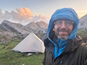
The crux of the climb up to the col – Collado de Tiro Torso (2500 m) – was a steep section of rock within a chimney. We could see the in-situ rope dangle over the obstacle, 50 m above us. To get to it we’d need to scramble along a crack – a rising traverse – step onto the face of wall, with lots of exposure, then ascend to a niche below the crux. “Shall we have a go without the bags?” said Jim. “Yeah, let’s do that”, I said. Jim led the way.

Jim and I have climbed together since we were 18 years old, first on the Aberdeen sea cliffs, then in our twenties and thirties, all around Britain on lots of bold memorable climbs: visiting Gogargh, Ben Nevis, Dumbarton Rock, Kinsey Crag, Malham Cove. Although Jim would modestly say he was not climbing fit, I had total trust in his competence and judgement. He has a huge capacity to focus, control his fear, and climb with balance and poise. We got to the niche where there was shallow cave or scoop below the crux. Jim backed into the scoop, saying “Just come in here for a minute Al. Get your head under that”. Jim reached for the rope and gave it a shake and we listened and waited. We’d been told by the hut guardian at Refugio Jermoso that there was a risk of loose rocks and we should take great care in pulling on the rope. We didn’t have helmets and the risk was plain to see. No sound, no falling rocks, nothing moved! With a look of relief and a nod of agreement to each other the risk had been assessed. This would be fine. The climb above use was doable and as long as we were careful not to disturb any rocks we could ascended safely to the col.
On the way back down, reversing the moves we’d do in a moment with 15 kg bags on our back, we saw another team comprising of six climbers approach the base of the route. We had enough time, they weren’t likely to overtake us, but their position below us raised the stakes. If we did dislodge any rocks above the crux they’d be hit, and they didn’t have any helmets either. Back at the niche, with our rucksacks, I started up the crux. I pulled myself up using some good handholds but I couldn’t find satisfactory foot placements. A more patient climber – i.e. Jim – would pause and choose a different line. I however, found a solution in reaching for the in-situ rope, swinging clumsily to the left and hauling myself up with my upper body strength. Above the crux, breathing heavily and a little rattled, I was safe but a bit disappointed in my floundering style. Jim made his ascent. He stepped out to the right onto a slab: more exposed, smaller holds, requiring greater bravery and skill than I possessed. With precise movements he joined me in no time. “That’s the Jim I remember”, I thought to myself. There’s a bond that’s formed with a climbing partner, an adventure companion, that’s meaningful and lasting, born of shared vulnerability, absolute trust and intense experiences. I was glad I’d made it out here to Spain. It had been too long since our last adventure.
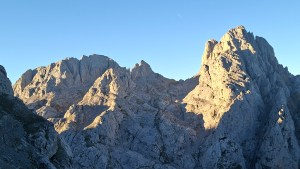
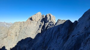
The rest of the climb to the col was undertaken in silence, as if quietness was necessary condition for our limbs to move slowly and precisely up the rock. At the top of the route, we stepped into the morning sunshine and looked east across the central massif of the Picos de Europa, a landscape composed of limestone cliffs, jagged peaks, depressions and caves. It was day seven of our trek through the mountains. Two days to go and we’d complete our round!
A week before, on 13th of September, I was in Santander walking the streets on a quiet Sunday morning, looking for a pharmacist. I was on my own. Jim had come out a few days before and was in Potes, our starting point for the trek. I’d felt lousy for the last 12 hours. I had achy flu-like symptoms. This was all to familiar, a legacy of a kidney infection years before. I was in a plaintive mopish mood and needed paracetamol. Thankfully, I found some, swallowed them down and headed to the bus station, for the 2 and half hour journey to meet Jim.
I wouldn’t normally take a break in September. Since starting the business 10 years ago, time off had always been a fixture of the winter months, when the season quietened down. But I hadn’t seen Jim properly in two years and I needed to prioritise that. “We could maybe go trekking in Greece, Norway or the Picos in Northern Spain”, I suggested. Jim has lived in Milan for over 15 years and has been in the habit of trekking interesting parts of Europe: the Lycian Way in Turkey, a traverse of the Serra de Tramuntana in Mallorca, the Selvaggio Blu in Sardina, the GR21 in Corsica. The Picos peaked Jim’s interest and a date was set for mid September.
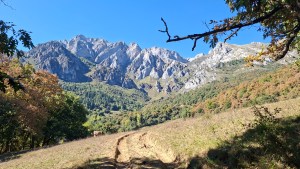

The Picos are a range of limestone mountains in northern Spain, formed of three massifs. The name comes from seafarers’ first sighting of Europe after a long passage across the Atlantic. The mountains in Spain in general have a much wilder, rugged quality to the overly-managed, commercialized slopes in the Alps. Fewer people with less rules; the Spanish mountains preserve a more raw, slower feel where wildlife and traditional farming still shape the landscape.

The objective for the trip was loosely framed at first: we’d do the El Anillo Tres Macizos, The Three Massifs Loop. I’d paid little attention to what that would entail. A busy season of guiding and running the business had delayed any detailed planning and it wasn’t until a few days before the trip that I read, with some anxiety, what it involved: 110 km of challenging rugged terrain with 9,500 m of ascent, typically undertaken over 10 days. We’d talk it through when we met, I judged. We’d find a way to make this work.
With big smiles and a hug Jim and I greeted each other in Potes. Our first task was to sort through kit and food for the expedition. Our intention was to camp, rather than Refugios: a cheaper, more austere style but at the expense of comfort and speed. Our bags were going to be heavy. We laid out on a park bench what seemed to be a ludicrous amount of food, nine days worth of grub: eggs, courgettes, garlic, peppers, carrots, apples, lemons, tomatoes, rice, pasta, couscous, chorizo, flour, cheese, oatcakes, butter, honey, olive oil, tins of sardines, coffee, hot chocolate etc. We rationed down the quantities, decanting unwanted food and travel clothes into a small rucksacks to stash somewhere later. Surely this would be enough food? Heaving on our rucksacks the weight was perhaps 20 kg, with about 8 kg of food each I figured. We also carried tents, stove, pots and pans, a kettle, tea-strainer, bivvy bags, head torch, sun cream, sunhat and a few odds and ends to make repairs and problem-solve. Off we set in the afternoon sun!

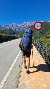
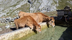
After an hour we reached a small hamlet, the last inhabited place before venturing up high. We filled our water containers with water – about 8 litres – from a fountain. There is next to no running water in the Picos. Rainfall dissolves away the limestone into sharp-edged rivulets, sinkholes and caves. Rather than flowing on the surface, water lies withing the mountain! Fountains were shown on the map with little blue circles. We were counting on finding them each day.
Above the hamlet, the trekking was uncomfortable. Our bags were very heavy, it was hot, and we were bothered by a swarm of flies, drawn to the sweat on our bodies. Above the treeline the flies receded and we continued up to a high meadow, our camp for the night. 1,200 m ascent done, on our first half day of trekking. Our camp was beautiful, pastoral and quiet, we enjoyed our first evening meal together as the sun slowly set, colouring the limestone cliffs yellow and then pink.
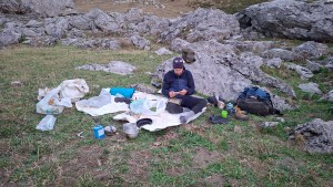

Over the subsequent days we established a good routine. Rising about seven, walking by nine, 4-5 hours of trekking in the morning and early afternoon, a break and early meal in the shade, then another 4 hrs or so of trekking, arriving at camp around 7 pm. Each day we noticed a small improvement in our ability to ascend: our fitness improved and bags lightened. We grew accustomed to a steady rate of ascent of 400 m an hour. With good pacing and patience we found we could tackle 1200 m ascents without too much trouble. The descents were harder. Our feet got really hot and we grew fearful of getting blisters.
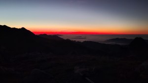
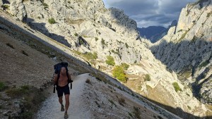
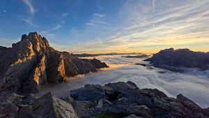
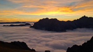
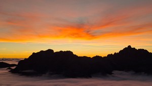
The landscape was breathtaking. Highlights included a mountain called Naranjo de Bulnes, a huge blank-faced monolith of steep rock. Then there was the Carras gorge on day three, a tremendously deep ravine with a balcony path cut into its side. Sunsets and sunrises were really special, some of the best I’ve ever seen. Up at 2000 m at Refugio Jermoso we looked west across a sea of cloud with mountains rising above, lit pink and red in the setting sun. That evening Jim and I ate in the refuge, enjoying good chat with other trekkers. After the evening meal everyone was drawn too a ridge above the hut and we stood transfixed in the still evening air, watching the sun set and the colours deepen and becomes richer and more intense: from pale pastel pinks to concentrated gold and crimson.



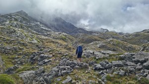
Added to the burden of heavy rucksacks and big ascents and descents was the challenge of navigation and route-finding. On day four in particular we had low cloud, drizzle and poor visibility. We journeyed across a section of mountains with no paths and only small intermittent cairns to show the way. Before we embarked on this tricky nav section, we chatted to the hut guardian at Refugio Vega de Ario,
“How long would it take to get to Refugio Vegarradonda” we asked.
“Are you going by the lakes?” he answered.
“No, through the mountains”
“Good luck”, he replied, “Lots of people get lost there”
With that sobering conversation we headed out into the mist. We had a wry smile on our faces, this was a cool challenge to take on. We relied heavily on interpreting the contours on the map, visualising the shape of the landscape and matching features to what lay before us. In karst topography, depressions and ring contours can be very hard to distinguish, both being shown as rings on the map. It was a challenge that Jim and I really relished, it was satisfying working through the landscape, picking out subtle spurs, r-entrants, ridges, lumps and bumps. Interestingly and a little disappointingly we appeared to be the only people navigating by map and compass. A common topic of conversation amongst trekkers was, “What Apps are you using?”. People looked aghast when they saw that we were just using a map. I kinda feel the culture of trekking and hill walking has irrevocably changed. Navigation with a map is in terminal decline. I fear it’s a craft that will be lost over time.

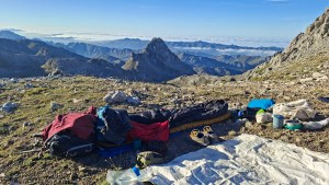
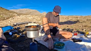
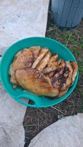
Our camps were another highlight. Much of the time we didn’t use a tent and just bivvied. It was never cold and straightforwardness of sleeping under the stars was delightful. We ate really well. Jim would do the chopping: onion, garlic, courgette, carrots, chorizo for example. I’d wash and cook the rice, saute the veg, sizzle the chorizo, stir in some delicious aubergine paste. Breakfast was especially good. Fruit salad with orange, lemon, honey and walnuts followed by scrambled eggs with mushroom, garlic and tomato; or, later in the trip pancakes made from scratch with lemon juice and honey. So delicious, but we did get hungry, especially me. After three or four days I really noticed my blood sugar was dropping and I was pretty ravenous. It turns out we didn’t have enough food and needed to top up in the village of Posada de Valdeon.

Importantly the journey provided lots of time to catch up with Jim. Throughout the day and particularly in the evenings there was time to share news and reminisce. We decided to vary the route a bit, lengthening it, taking in some peaks and venturing onto more technical ground like our climb over Collada de Tiro Torso. I am not entirely sure of the distance we covered but our ascent was 10,500 m over nine days. It was tough, but just right in terms of challenge. I think this range of mountains is amazing and would highly recommend it anyone looking for some adventure.